Even in its heydey, the community of Tallman, Oregon was little more than a wide spot on the rail line between Albany and Lebanon. It started life as an intersection between a north-south rail line running from Eugene to Stayton (I think it was) and the east-west rail line between Albany and Lebanon. But even before the McClains moved to Tallman in 1917, the rail line north out of Tallman was already gone, having been relocated to Lebanon. This left a “T” intersection between the Eugene line and the Albany-Lebanon line.
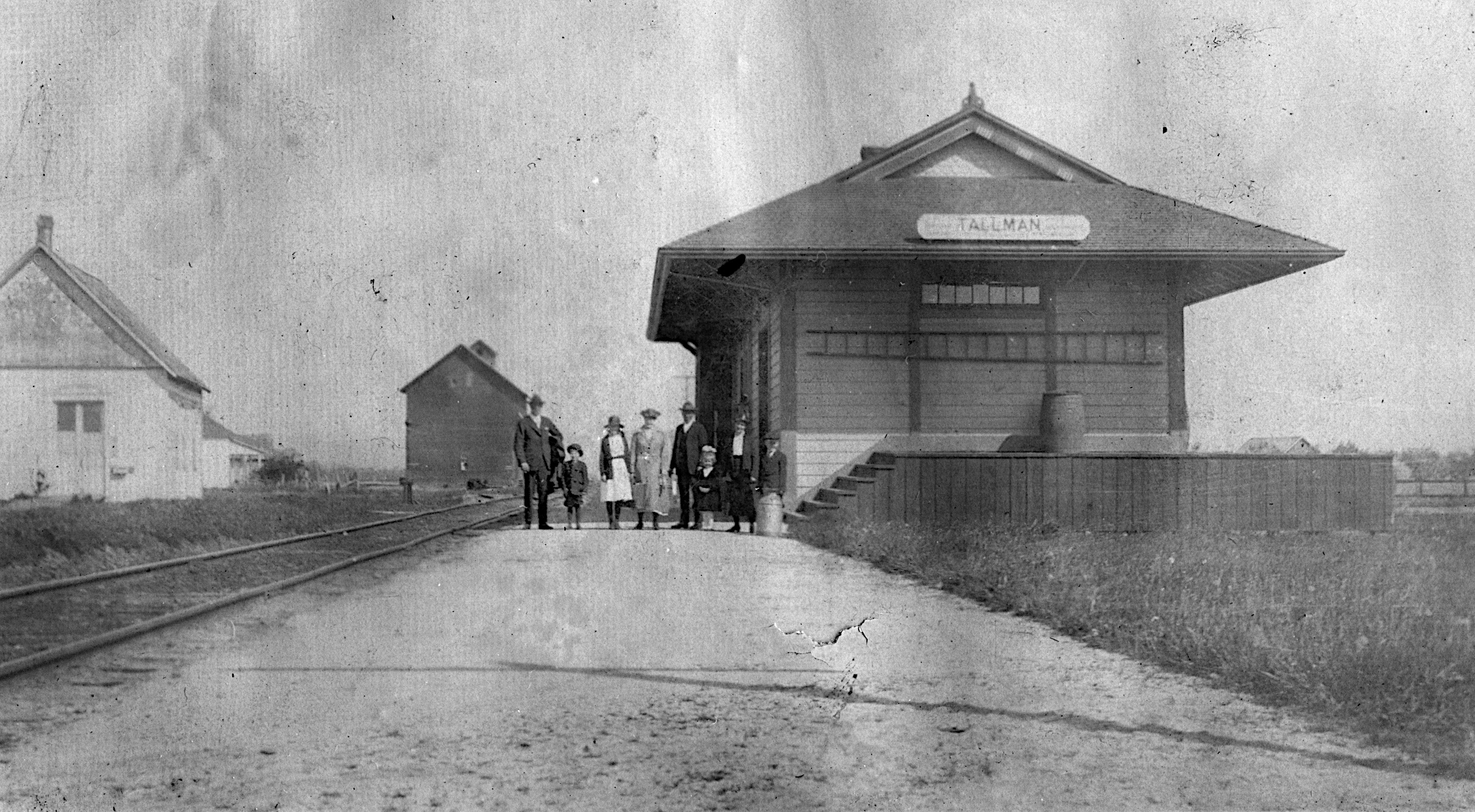
Tallman had no store. Just the train depot, two churches and a community hall.
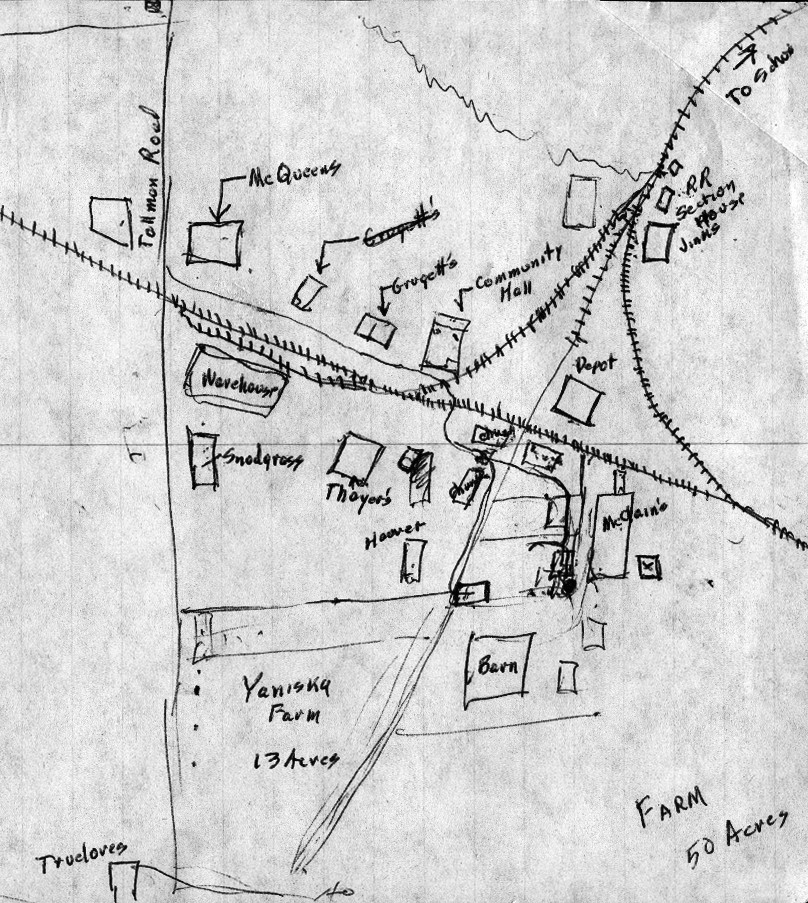
As you can see from this map, the McClain farm was a significant part of the “central Tallman” area (by which I mean the area close to the train depot).
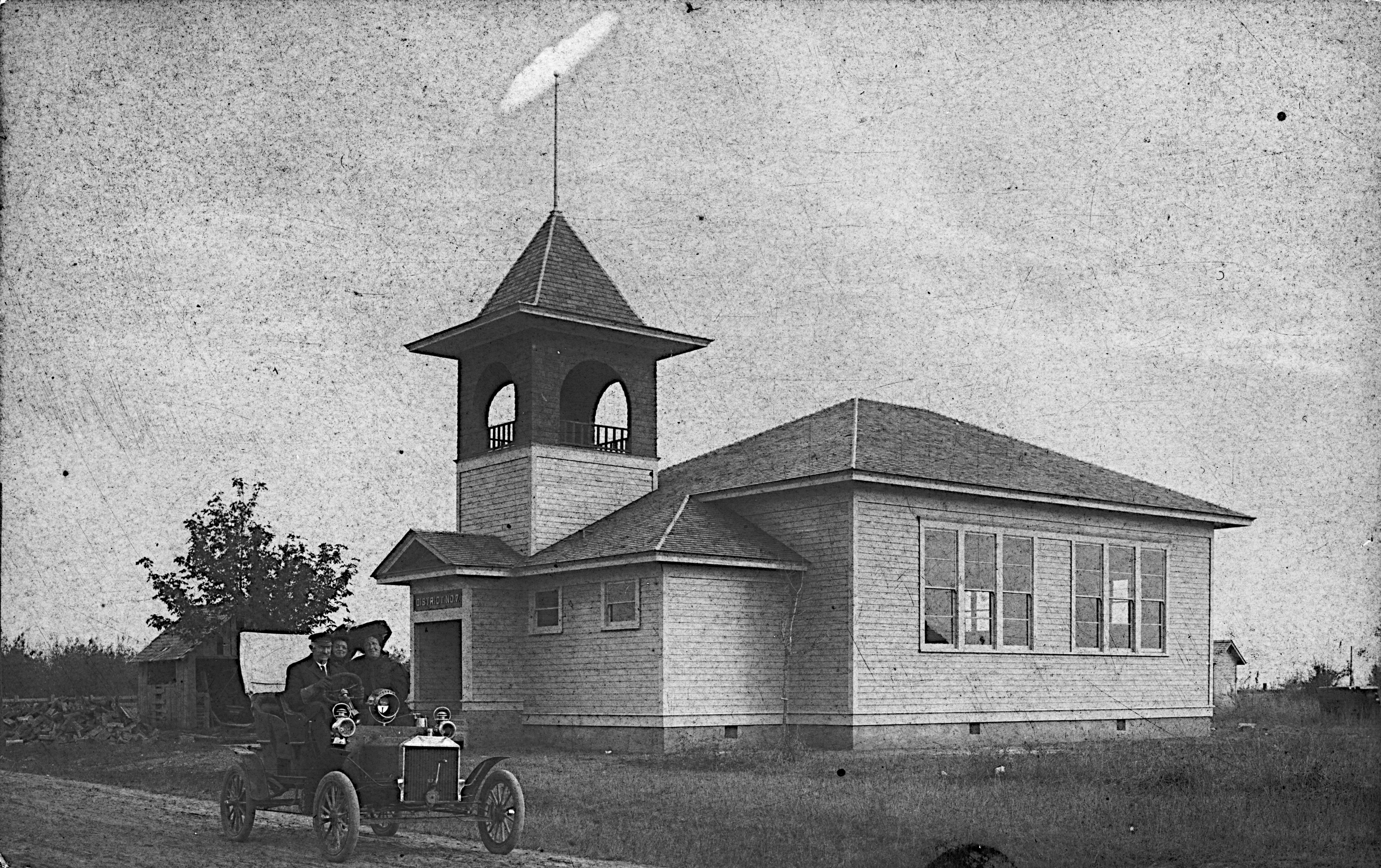
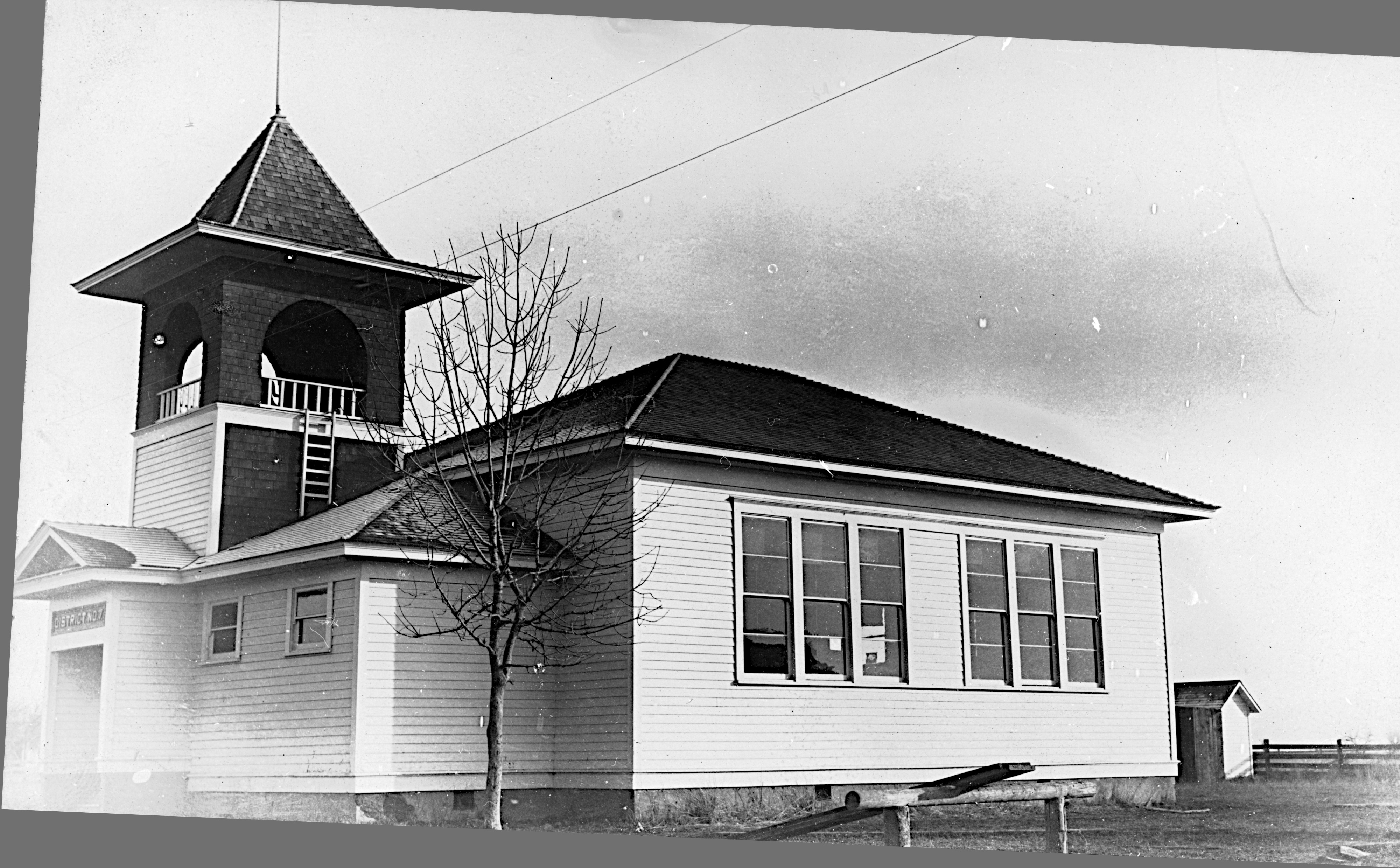
The life of the community seems to have centered around the school and the community hall. Sad to say, I am not aware of any photos of the community hall. But there are photos of the school.
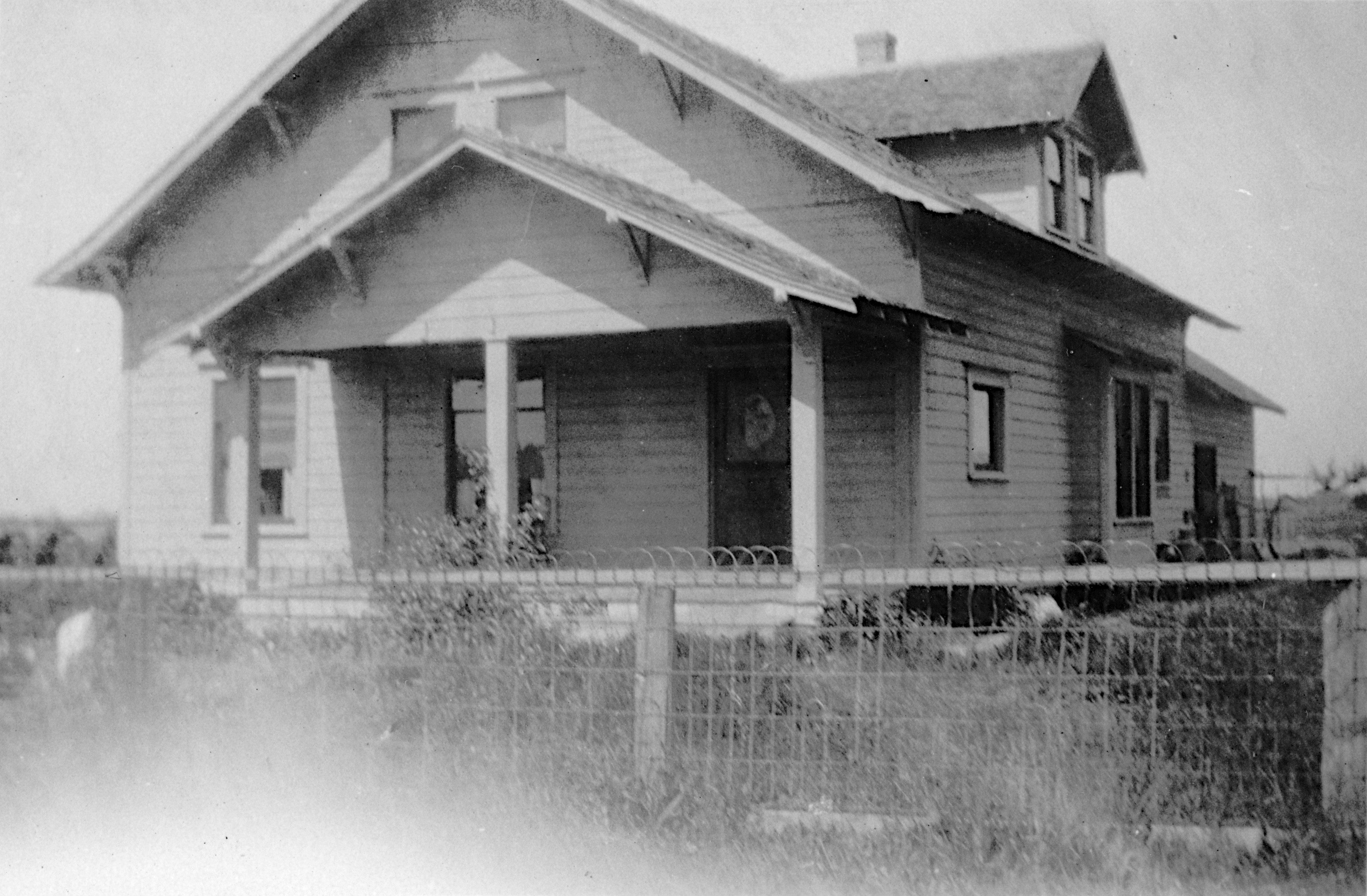
None of these buildings still stands today. The rail line south to Eugene was demolished in the 1960s or 1970s. (There appears to be a trestle across a creek in the middle of a field that still gives a hint that there used to be a rail line there.) Other than the name of Tallman Road, you would be hard pressed to find any sign that the community ever existed. If I’m not mistaken, one house (I believe it’s the Thayer house on the map above) and the McClain barn are the only buildings that remain from the Tallman community of the 1920s.
Love, Love, Love seeing these pictures, Lloyd! Some EARLY childhood memories jump up for me!! Remember dipping graham crackers in milk sitting on the front porch of their house with Grandma Mc , watching for a train to go by ….rare!! Donna, do you remember this?
Thank you for this great summary of the rise and fall of the Tallman community! Your pictures and description fit right in with my memories of what Dad said about the town! John and I stopped by last September to see the barn again!
Great pictures! When I stayed overnight with Grandpa and Grandma, it seemed that all night long, I could hear a locomotive rearranging train cars; it was a comforting, reassuring sound. Uncle Bernard’s map reassures me that my memory of the layout of Tallman is pretty good.