This page of Dad’s photo album shows a flood of the Santiam River in April 1931.
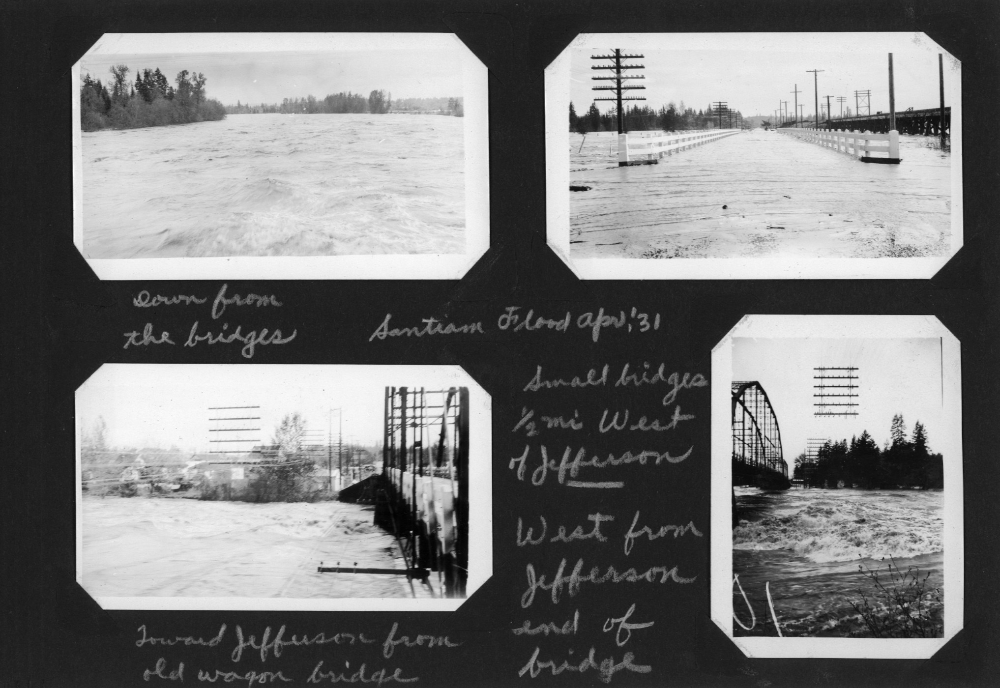
The first photo of the set is the view downstream from the bridges at Jefferson.
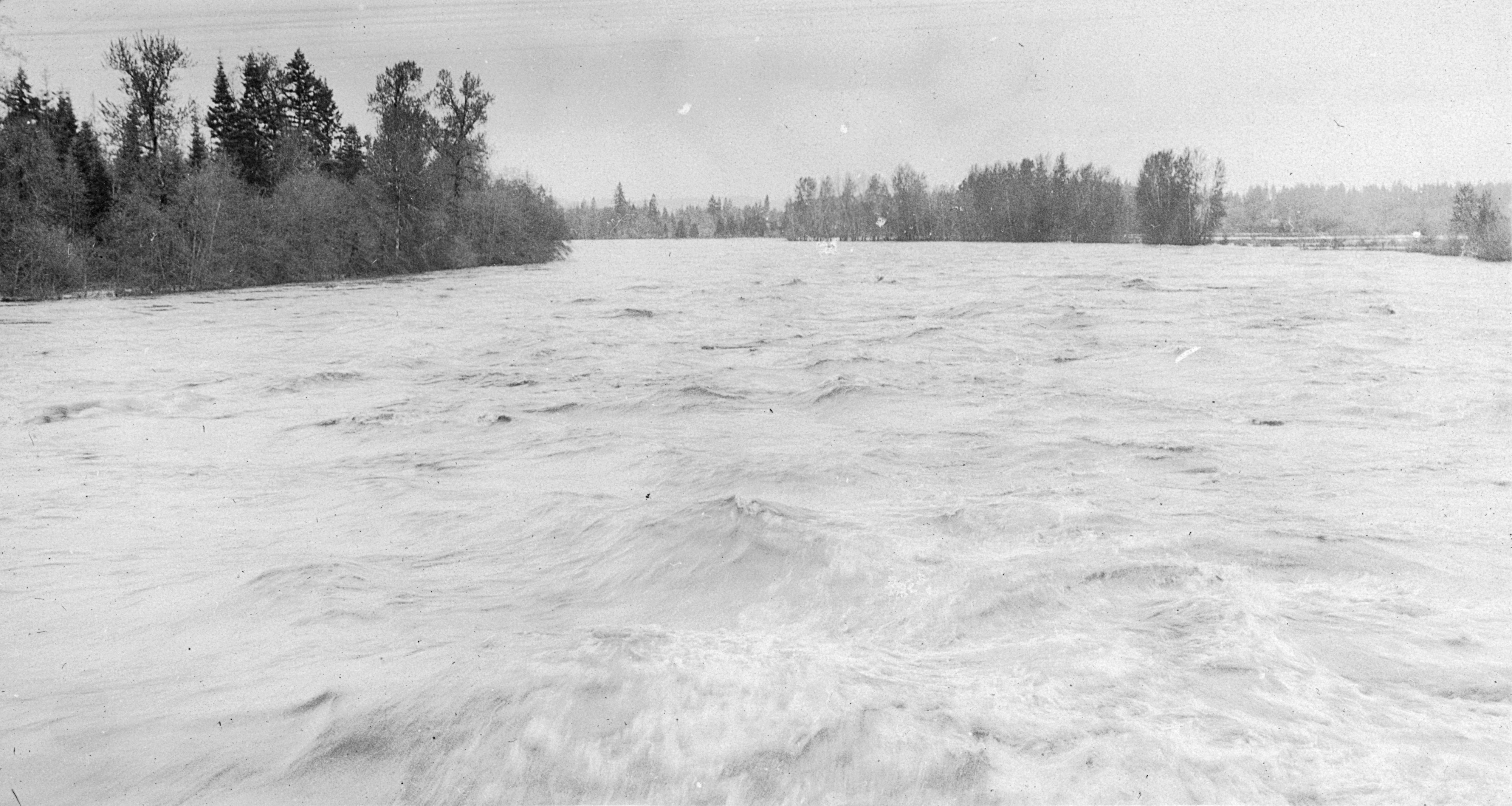
The second photo looks east across flooded bridges about half a mile west of Jefferson on the highway. These bridges span areas of low ground that normally would be dry, but here water is flowing over the tops of the bridges.
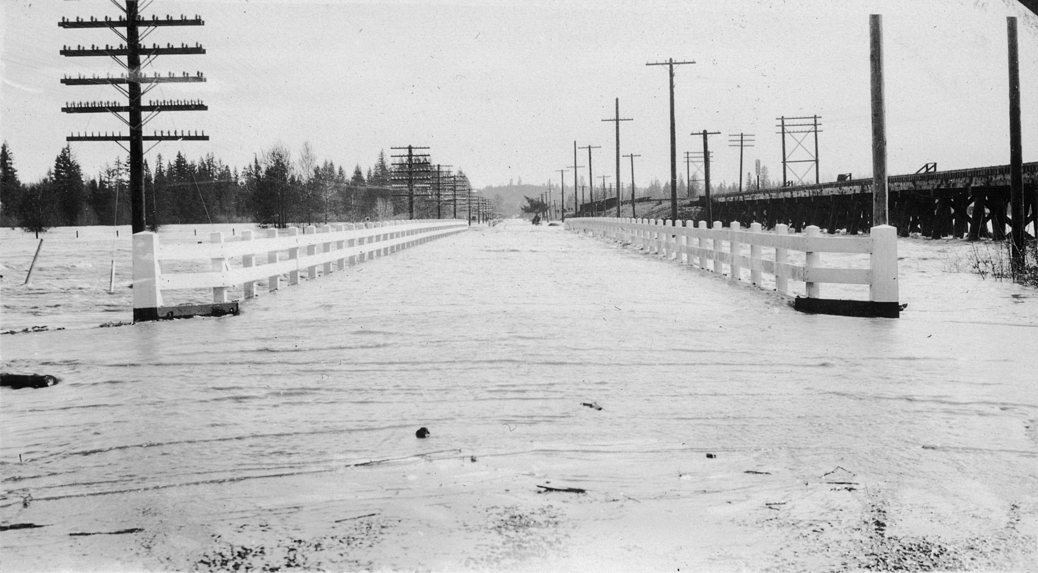
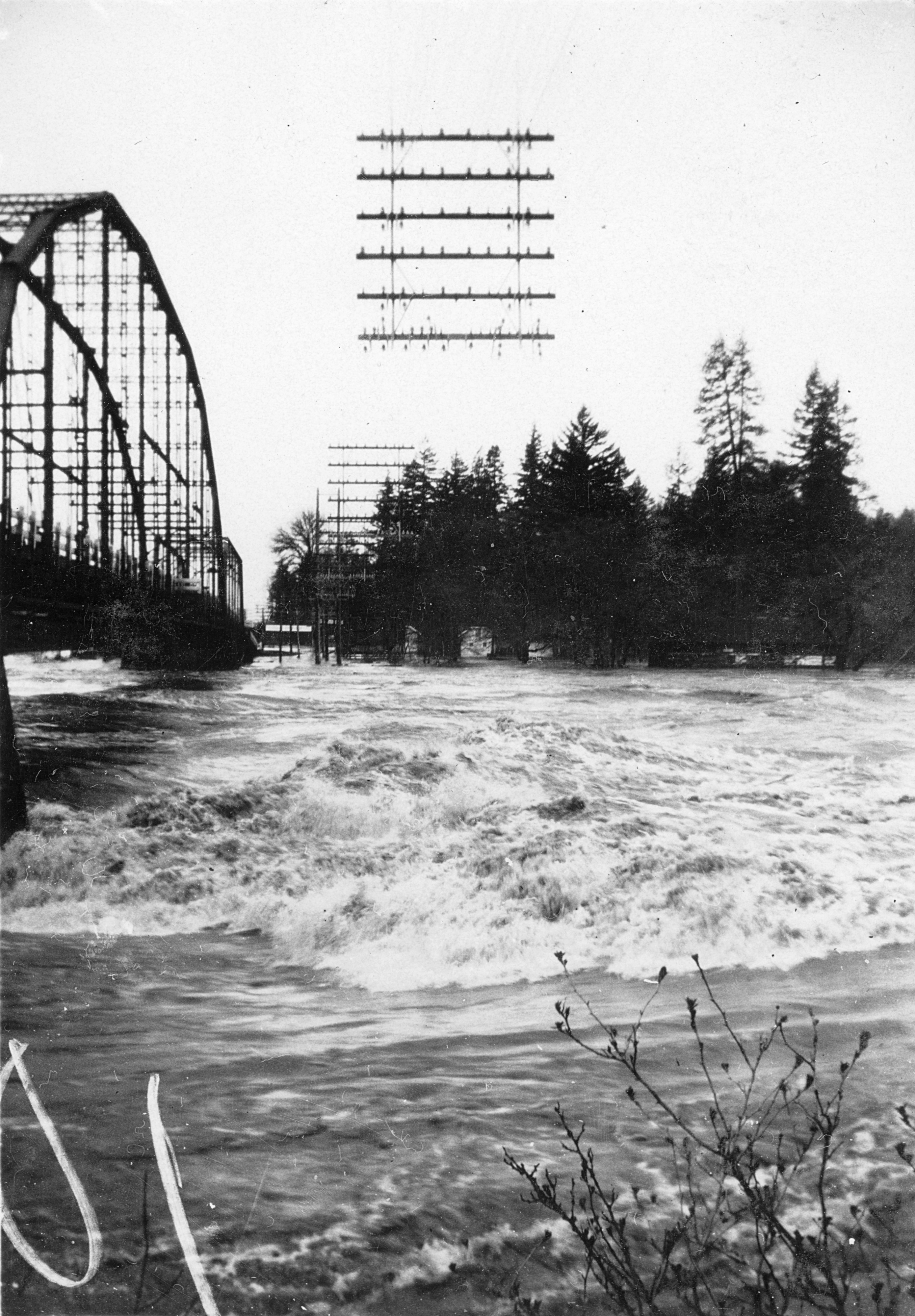
The third photo looks across the swollen river toward Jefferson. On the right edge of the frame is the Wagon Bridge. This bridge, which had been built in the early 1910s, was soon to be replaced by the Jacob Conser bridge (a concrete arch design completed two years later, 1933). That bridge is still in service as I write this.
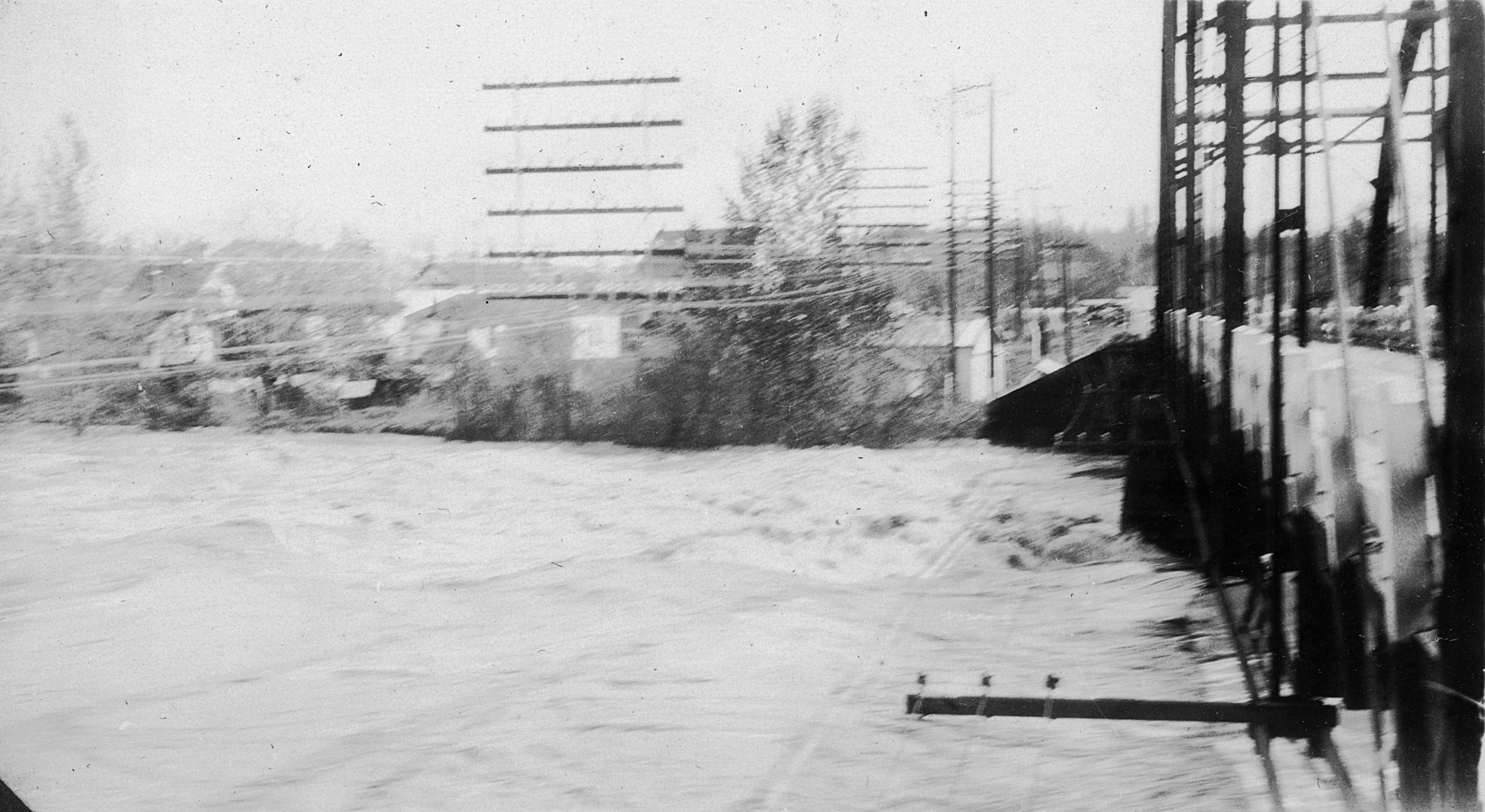
The final photo of the set looks across the river from the Jefferson side near the same bridge.
For comparison with the above photo, this image and this image on the City of Jefferson website show what the Wagon Bridge looked like at more normal river levels.
According to NOAA, the crest of the Santiam at Jefferson on April 1, 1931 was the 23rd highest on record.
I am struck by all the wires along roadways in these photos– massive racks supporting dozens and dozens of wires or cables. I have the vaguest recollection that some of those were still around when I was a child (close to 30 years later), but they disappeared from the landscape pretty quickly. What a nightmare it would have been to maintain all those runs of wire, and to troubleshoot them when something went wrong!