The next few pages of Dad’s photo album display photos he took of scenery at various times and places. Here is the first of those pages:
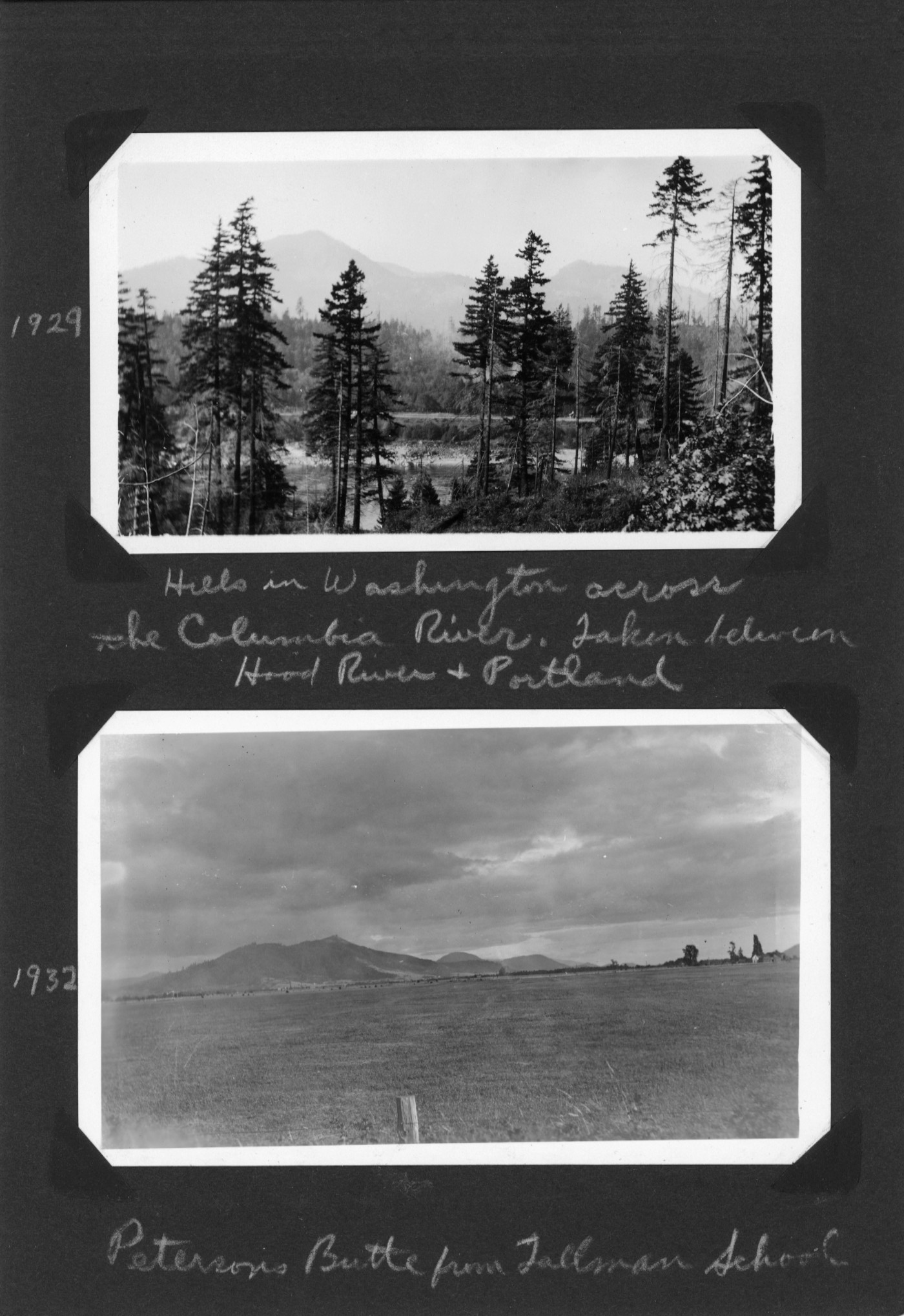
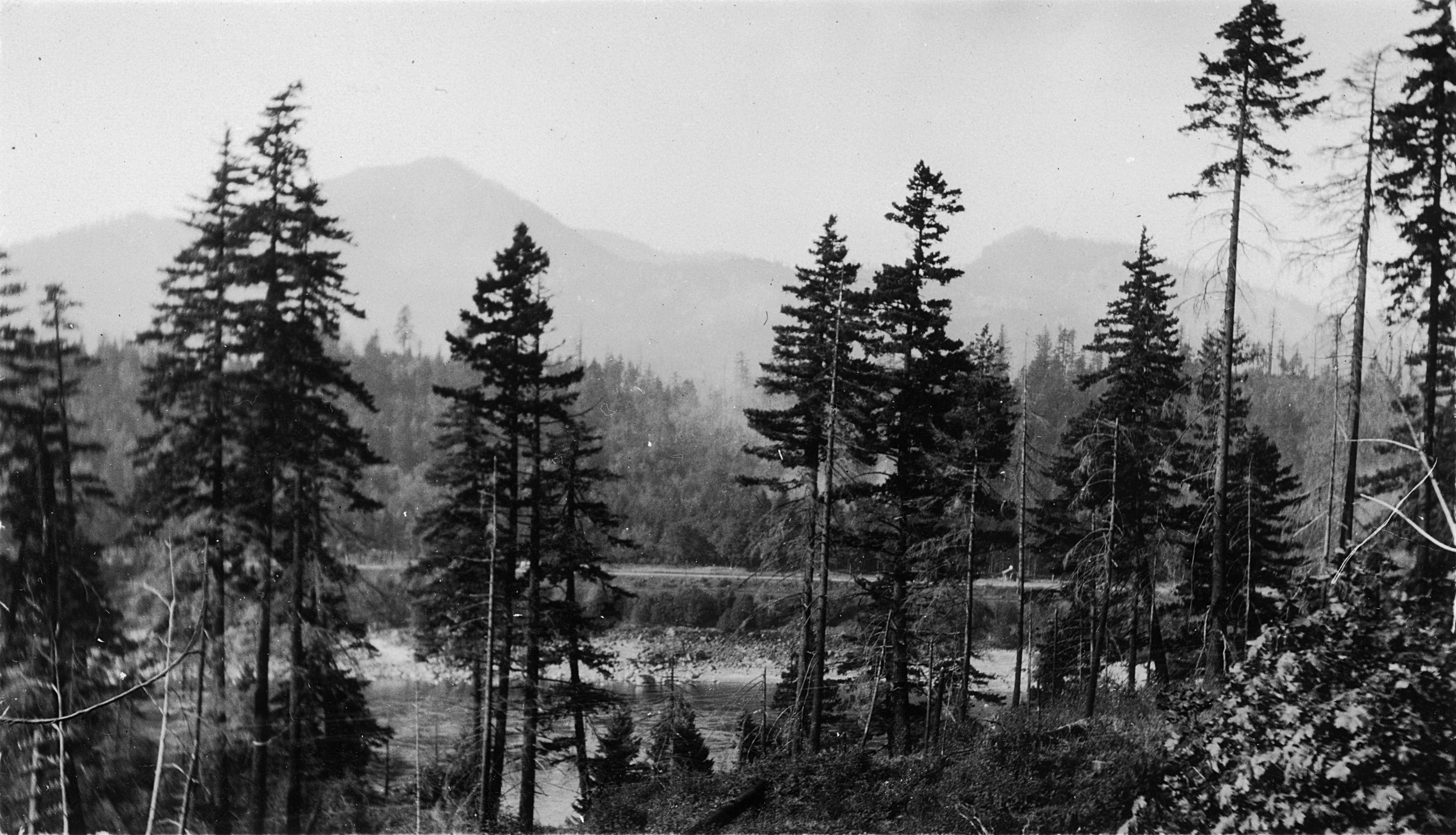
The first photo was taken in the Columbia Gorge (though Dad says only that it was “taken between Hood River and Portland”). It looks north into Washington from the Oregon side of the gorge. Dad took this photo in 1929.
The second photo was taken west of Lebanon, looking south toward Peterson Butte from Tallman School (which no longer exists). Dad took this photo in 1932.
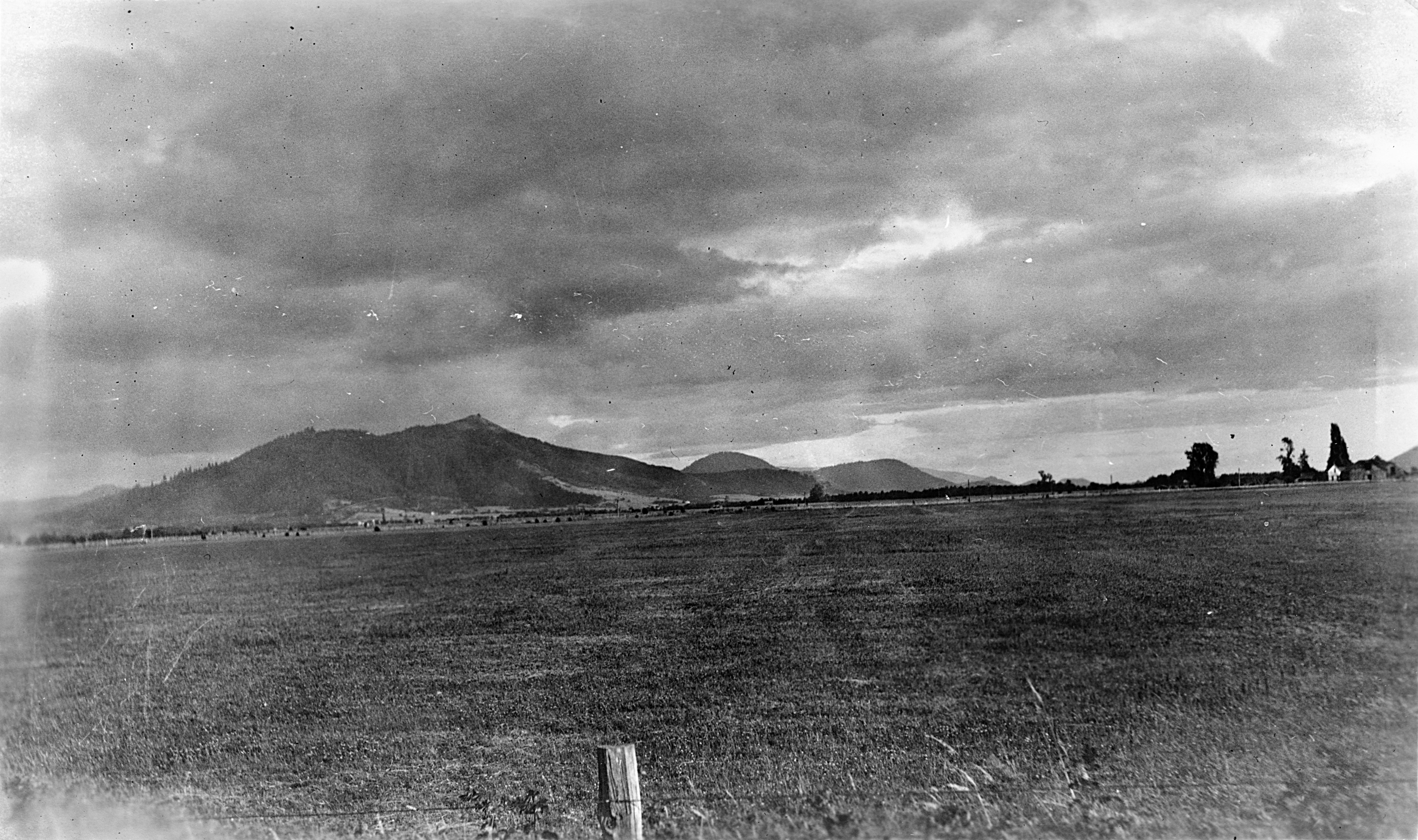
Peterson Butte is the double-peaked hill in the left half of this photo. It is interesting to see what it looked like without any antennas or microwave towers on it. With an elevation of 1430 feet, the butte is the highest point in the surrounding valley for some distance, and so has acquired both in more recent times.
The summit of Peterson Butte was a popular hiking destination in the area in the 1920s. At the present time ascending the summit involves crossing private property. Most years there is at least one organized hike to the top where permission from the owners of said property has been obtained.
Art writes:
Perhaps someone could help me, but I think that might be Dog Mountain across the way in the first photograph. It is interesting to me that the mighty Columbia seems narrow. But of course there were no dams on the Columbia at that time! …
Also to ponder, the now-old Columbia River Highway, which he must have been on, was just 14 years old when the picture was taken.