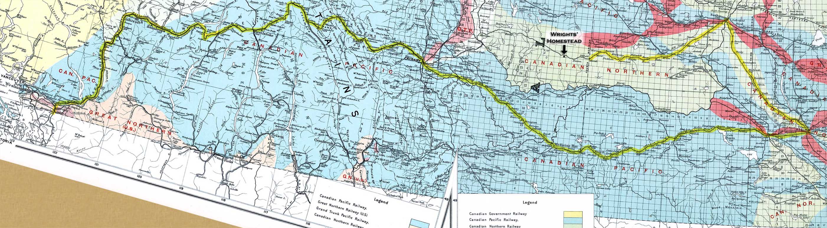
The likely route taken by the Wrights' immigrant train is highlighted on these pages from a 1915 Canada Atlas. This reconstructed route is based primarily on Irvine's memoirs. The border crossing was at Sumas, Washington, northeast of Bellingham (where the highlighted route begins at far left). Snohomish is slightly off the bottom of the map below this point. The location of the Wrights' homestead is indicated above and to the right of center. To judge distance, note that each small square on the map is a township, approximately six miles on a side.
The highlighted line running southwest out of Saskatoon (top right) is the Canadian Northern Railroad's Goose Lake Line. Eventually it would run all the way to Calgary (near center), as indicated on this map. But in 1911, it was completed only as far as Alsask, on the Alberta/Saskatchewan border. (The border coincides with the line labeled “Fourth Meridian” on this map).
This route would have involved many switches between railroads or rail lines, each with a significant layover, no doubt, just as Lloyd describes.
|